UN
2 Foye Lane
£ 320,000
Description
We don't have a Description for this property.
- Bedrooms
- 4
- Bathrooms
- 0
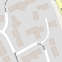

Leaflet © OpenStreetMap contributors
The heatmap indicates the level of crime in the area. The color of the heatmap indicates the crime severity and recency.
Metrics Year-on-Year
- Average area value
- 220,958.00 £Increased by 13.54 %
- Average area rental value
- 984.00 £/moIncreased by 7.31 %
- Est rental Yield
- 5.34 %Decreased by 5.49 %
- Crime Rate
- 26.00 %Unchanged by 0.00 %
from 194,601.00 £
from 917.00 £/mo
from 5.65 %
from 26.00 %
Nearby Schools
| Name | Type | Ofsted | Distance |
|---|---|---|---|
| Wild Rose Children'S Centre | Children's Centre Linked Site | 0.51 KM | |
| Tweseldown Infant School | Community School | Outstanding | 0.51 KM |
| Church Crookham Junior School | Community School | Outstanding | 0.65 KM |
| Velmead Junior School | Community School | Good | 1.31 KM |
| Fleet Infant School | Community School | Outstanding | 1.36 KM |
Images
Nearby Streets
| Name | Average Price | Average Sqft | Distance |
|---|---|---|---|
| Kenmore Close | £ 925,000 | 0 | 0.00 KM |
| Gordon Avenue | £ 550,000 | 0 | 0.00 KM |
| Hamilton Road | £ 0 | 0 | 0.00 KM |
| Naishes Lane | £ 800,000 | 0 | 0.00 KM |
| Award Road path | £ 0 | 0 | 0.00 KM |
Nearby Transport
| Name | NLC | TLC | Distance |
|---|---|---|---|
| Fleet | 5522 | FLE | 3.13 KM |
| Farnham | 5545 | FNH | 6.87 KM |
| Aldershot | 5623 | AHT | 7.74 KM |
| Farnborough (Main) | 5521 | FNB | 8.83 KM |
| Winchfield | 5528 | WNF | 9.09 KM |
Nearby Listings
| Address | Price | Type | Score | Distance |
|---|---|---|---|---|
| Redwoods Way, Church Crookham, Fleet | £ 225,000 | BUY | 6 / 10 | 0.12 KM |
| Aldershot Road, Church Crookham, Fleet | £ 600,000 | BUY | Unknown | 0.17 KM |
| Compton Road, Church Crookham, Fleet | £ 425,000 | BUY | 7 / 10 | 0.18 KM |
| Compton Road, Church Crookham, Fleet | £ 600,000 | BUY | 7 / 10 | 0.20 KM |
| Azalea Gardens, Church Crookham, Fleet, GU52 | £ 650,000 | BUY | 7 / 10 | 0.21 KM |
Nearby Properties
| Address | Price | Distance |
|---|---|---|
| 6 Foye Lane | £ 690,000 | 0.00 KM |
| 5 Foye Lane | £ 545,000 | 0.00 KM |
| 2 Foye Lane | £ 320,000 | 0.00 KM |
| 8 Haig Lane | £ 158,500 | 0.08 KM |
| 17 Haig Lane | £ 81,000 | 0.08 KM |